Annual maintenance work will take place again this summer, which is why the reading rooms at the Heldenplatz location and in all collections will be closed from Friday, July 25, to Tuesday, August 5, 2025.
Due to the shutdown of the ordering system, no media orders can be accepted from Thursday, July 24, 2025, 4 p.m. to Tuesday, August 5, 2025, 4 p.m. The regular opening hours will then apply again from Wednesday, August 6, 2025.
The study room of the Albertina is closed from July 15 to August 15. During this time (except July 25 to August 5), media ordered from the Albertina collection will be transported twice a week (Monday and Thursday) to the reading rooms of the National Library on Heldenplatz and can be used there.
Starting August 1, 2025, the State Hall will open at 9 a.m.
Due to an event, the State Hall will be closed on August 4, 2025.
Please note that detailed information is available in German only.
Thank you for your understanding!
Erhard Etzlaub: Umgebung von Nürnberg, 1492
Marcus Beneventanus: Mitteleuropa, 1507
Westafrika, vor 1508
Martin Waldseemüller: Weltkarte, ca. 1520
Hernán Cortés: Stadtplan von Mexico, vor 1522
Vorderösterreich-Niederösterreich, um 1540/50
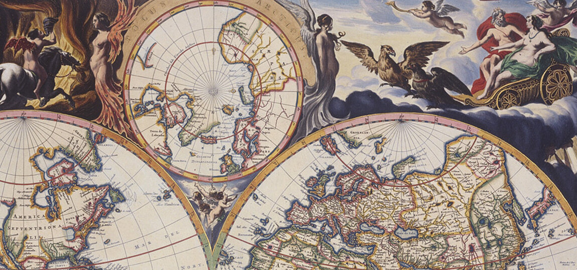
Gerard Mercator: Globenpaar, 1541, 1551
Pero Fernandes: Weltkarte, um 1545
Sancho Gutiérrez: Weltkarte, 1551
Wolfgang Lazius: Kriegsschauplatz in Westungarn, 1556
Paulus Fabricius: Mähren, 1569
Leonhard Thurneisser: Astrologisches Universalastrolabium, vor 1575
Antonio Millo: Östliches Mittelmeer, 2. Hälfte 16. Jahrhundert
Balkanhalbinsel, 16. Jahrhundert
Vogelschauansicht von Aquileia, um 1600
Matteo Ricci: Weltkarte, 1602/nach 1644
Warmund Ygl: Tirol, 1604
Philipp Eckebrecht, Johannes Kepler: Weltkarte, 1630/nach 1658
Hilarius Duvivier: Zillertal, ca. 1630
Ansicht von New York, um 1650
Atlas der Levante, um 1656
Francesco Giuseppe Bressani: Jesuiten in Kanada, um 1650
Andreas Cellarius: Planetensystem, 1661
Atlas Blaeu-Van der Hem, 1662-1678: Nicolas Joannes Visscher: Weltkarte
Atlas Blaeu-Van der Hem: Geheimatlas der VOC, um 1666
Vincenzo Coronelli: Globusstreifen, 1696
Festungsplan von Narwa, 1700
Die Berge von Montsant, 1. Hälfte 18. Jahrhundert
Leander Anguissola, Johann Jacob Marinoni: Wien, 1704
Walachei, 1707
Francesco Cassiano de Silva: Königreich Neapel, 1708
Werner Arnold Steinhausen: Wien, 1710
Johann Christoph Müller: Mähren, 1712
China, 1719
Samuel von Schmettau: Sizilien, um 1721
Leopold Franz von Rosenfeldt: Strudengau, 1721
Johann Jacob Marinoni: Jagdatlas, um 1725
Joseph Patino: Belagerung von Oran, 1732
Joseph Mräkh: Bergwerksplan von Idria, 1746
Andreas Spitzer: Armillarsphären, 1764
Joseph Daniel von Huber: Vogelschauansicht von Prag, 1769
Josephinische Landesaufnahme von Niederösterreich, 1773–1781
Schloss Laeken, um 1780
Leopold Paur: Die Stadt im Traum, 1784
Carl Graf Vasquez: Triest, 1830
Alois Negrelli, Adolphe Linant de Bellefonds: Suezkanalplanung, um 1845
Jakob Alt: Klosterneuburg, 1847
Josef Selleny: Brasilien, 1860
Valentin von Streffleur, Anton Steinhauser: Relief nach der Schichtenkarte der österreichischen Monarchie, nach 1865
Julius Payer: Franz Josefs Land, 1874